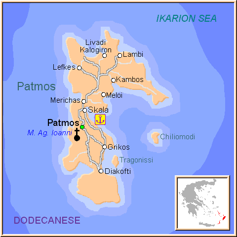
Patmos island map – attactions, towns, villages, roads, streets and beaches !!
Patmos, situated between Leros and Ikaria, is a mountainous island with rocky soil and an abundance of small coves. The majestic fortress monastery crowns the hill above the port, surrounded by dazzling white, cubelike houses which spill down its flanks.
Interspersed among them are miniscule churches and grand sea captains’ mansions, separated from each other by narrow lanes, high walls and small squares opening onto breath catching views over the Aegean. Ships arriving at Patmos dock in the island’s harbour, Skala, a lively place with its white houses, flowered courtyards, fish tavernas, hotels, restaurants, cafes and shops. North of Skala is the village of Kambos, set among trees and greenery, and near it is what many consider to be the island’s finest beach.
Take a look at our static and interactive Google map, showing major places in Patmos island and providing regional travel information.
We’ve highlighted the most well-known villages, towns and beaches using pointers. Don’t forget to drag the map around and zoom in to see places in more detail – and to use street-view also !!!
Read more


