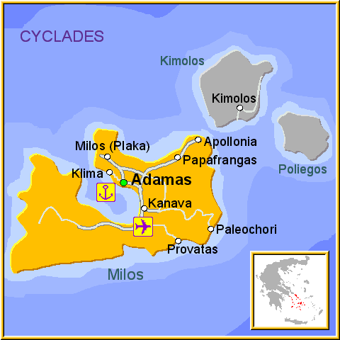
Milos island map – attactions, towns, villages, roads, streets and beaches !!
The Greek island of Milos, has a dramatic coastline that contains spectacular volcanic rock formations. Milos is a combination an industrial and tourist island, it has vast mineral deposits which continues to bring wealth to the island. Milos has remained comparatively undiscovered by the package holiday industry, but is a firm favourite with holidaying Greeks. The port of Adamantas is inside a large bay and is considered to be one of the safest natural ports in the Aegean. In the summer the area around the waterfront, lined with cafes, restaurants and shops, can become quite busy. On the top of the hill, over 200 metres above the port of Adamantas stands Plaka, the main town on Milos island.
Take a look at our static and interactive Google map, showing major places in Milos island and providing regional travel information.
We’ve highlighted the most well-known villages, towns and beaches using pointers. Don’t forget to drag the map around and zoom in to see places in more detail – and to use street-view also !!
Read more


