welcome to Thessaloniki – GREECE
Online Thessaloniki map
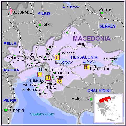
showing major places in Thessaloniki.
Find the places to visit in Thessaloniki map. Detailed tourist and travel map of Thessaloniki in Greece
providing regional information. Thessaloniki road map and visitor travel information. Download and print out free Thessaloniki maps.
Greece’s second largest city, capital of Macedonia in the north, was the realm of Alexander the Great and named after his sister, Thessaloniki, when it was founded in 316 BC. It sits in a bowl framed by low hills, facing a bay on the Gulf Thermaikos. Despite being one of the oldest cities in Europe, today Thessaloniki is lively and modern, more attractive than Athens with wide avenues, parks and squares. In 1917 most of the city was destroyed in a massive fire, and rebuilt later. This is not a high-rise city, though, because the area is prone to earthquakes and regulations have been imposed preventing the building of skyscrapers. This means that residents and visitors alike can enjoy the seaside situation of Thessaloniki, with views aplenty from the city streets. The main squares are Platia Elefterias and Platia Aristotelous, both on the waterfront and alive with cafes and restaurants, children playing or people just strolling. Thessaloniki, having been under Ottoman rule for long periods in its history, has been left a legacy of numerous Byzantine churches, and museums housing Byzantine art and artefacts. Thessaloniki city also has a heritage of early Christian communities, particularly the renowned monasteries of nearby Mount Athos.
Greece – Cyprus map – Chalkidiki – Aegina – Naxos – Nafplion – Kefalonia – Zante – AthensAthens